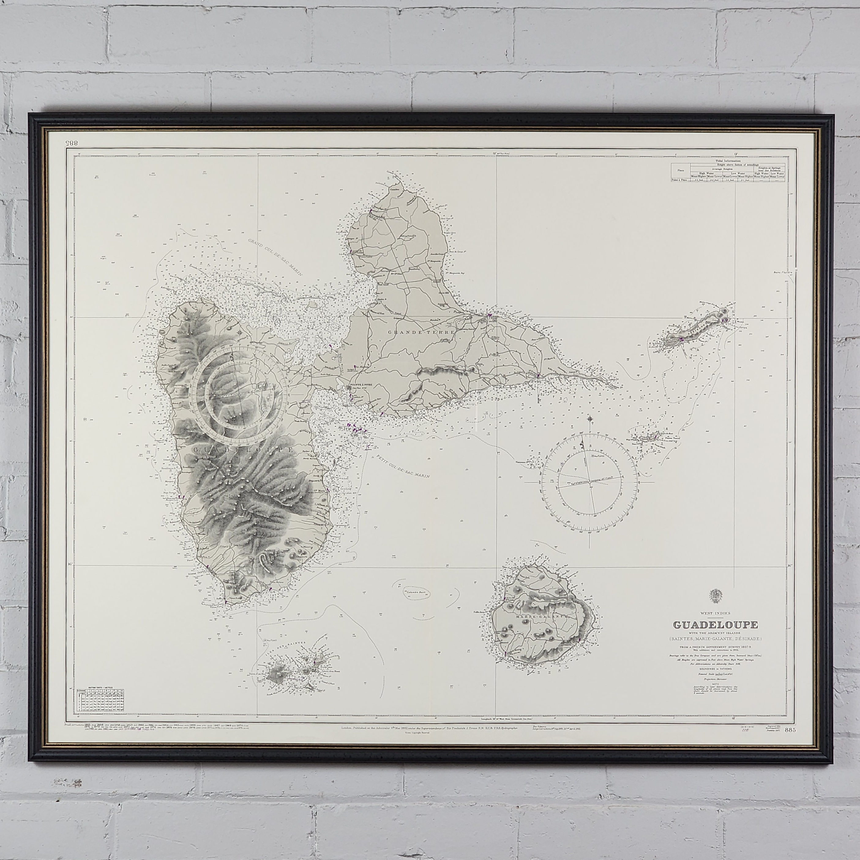

A late 20th-century reprint (1981) of a 19th-century Admiralty chart, showing the island of Guadeloupe with adjacent islands Iles des Saintes & Marie-Galante, from a French government survey, 1867-69.
Title to the lower edge; London: Published at the Admiralty...under the Superintendence of Sir Frederick J. Evans, 6th March, 1882 [with large corrections to 1955 and small corrections to 1983].
The overall condition is very good with only very light folding to the centre. Compass roses, soundings marked in fathoms, and some spots on the map marked in magenta. Cancelled – not to be used for navigation.
Vintage Admiralty Chart 885 - Guadeloupe with Adjacent Islands
£200.00Price
Height: 76cm
Width: 83cm